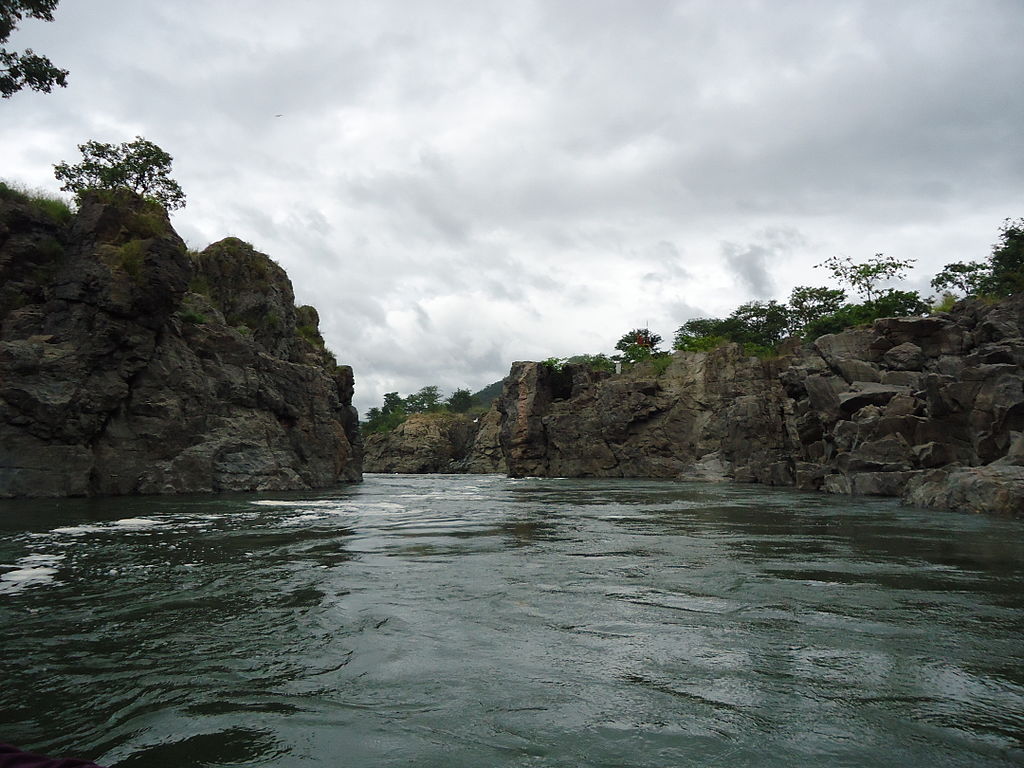
The 10 largest rivers in India:
India is known as a river country because of the numerous rivers that run through it. the largest rivers in India will be discussed in this article .India’s rivers are classified into two types: Himalayan Rivers (rivers that originate in the Himalayas) and Peninsular Rivers (rivers that originate in the Peninsula). Peninsular rivers are rainfed, whereas Himalayan rivers are perennial. In this article, we will discuss the major and largest rivers in India.
Some rivers are considered sacred by Hindus, and some are even worshipped as gods and goddesses. Take a look at the list of the Largest rivers in India below!
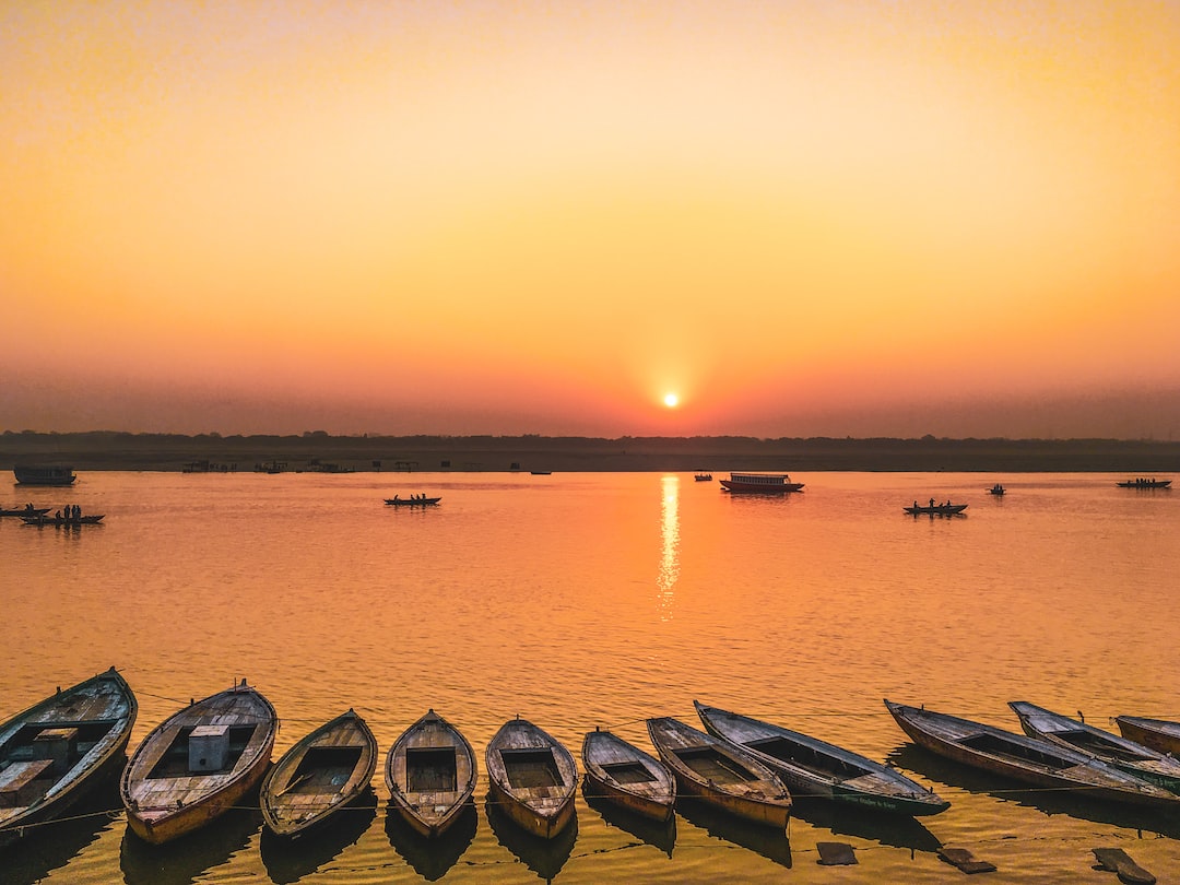
- Ganga 2525km
- Godavari 1465km
- Yamuna 1376km
- Narmada 1312km
- Krishna 1300km
- Indus 3180 (1114 km in India)
- Brahmaputra 2900 (916 km in India)
- Mahanadi 890km
- Kaveri 800km
- Tapti 724km
1. Ganga
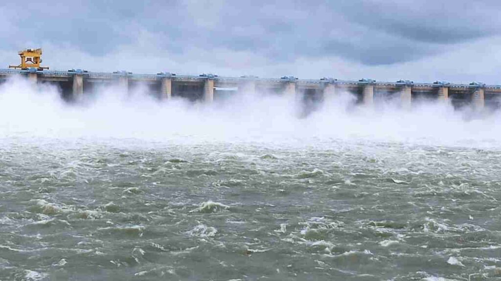
The Ganges has captured the heart of the country and drawn countless millions to her banks. The Ganges, also known as the Ganga, is India’s longest river and one of the most sacred rivers to Hindus. one the largest rivers in India is also the world’s third-largest largest river in terms of discharge. The Ganges is a transboundary Asian river that begins in the western Himalayas and flows through India and Bangladesh. It is a symbol of faith for Indians and a source of income for a large number of people. When it reaches West Bengal, it divides into two rivers, ‘The Padma’ and ‘The Hooghly.’ The Padma River flows through Bangladesh before emptying into the Bay of Bengal.
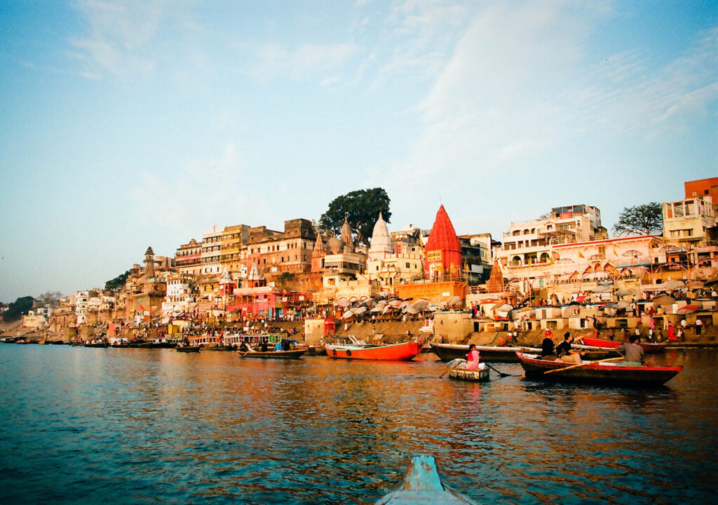
In Hindu tradition, the Ganges is revered as a Goddess and mother. A pilgrimage to Ganges is considered a religious ritual, and a dip in the holy water of the Ganges is believed to cleanse a person of all his past wrongdoings.
The main tributaries of the Ganges are Gomti, Tamsa, Ramganga, Punpun, Mahanada, Ghaghara, Yamuna, Burhi Gandak, Son, Gandaki, and Koshi. The States through which the Ganges flows include Uttarakhand, Uttar Pradesh, Jharkhand, Bihar, and West Bengal.
Some of the important cities through which the Ganges past include, Varanasi, Munger, Ghazipur, Ballia, Bhagalpur, Buxar, Patna, Haridwar, Rishikesh, Kanpur, Allahabad, Farrukhabad and Jajmau.
The largest delta in the world, ‘The Sundarban delta,’ is formed at the mouth of the river Ganges. The Ganges is regarded as the fifth most polluted river across the globe. The Ganges water seen after Haridwar is not the actual Ganges as the original water of the river is brought out in Narora and Bhimgoda. The water that flows afterward is the groundwater, the water from contributing rivers and sewage.
2. Godavari
The Godavari river system is Peninsular India’s largest river system. The Godavari basin encompasses the states of Maharashtra, Andhra Pradesh, Chhattisgarh, and Odisha, as well as smaller portions of Madhya Pradesh, Karnataka, and Puducherry (Yanam).
The river is 1,465 kilometres long and is considered the country’s second-longest river (after the Ganges).
Origin – The River rises in the Sahyadris, near Trimbakeshwar in the Nashik district of Maharashtra.
Godavari river originates from Bramhagiri mountains at Trimbakeshwar.The river flows across the Deccan Plateau from the Western to the Eastern Ghats. The river flows in southeast direction across south-central India states. After flowing for about 1,465 km., in a generally southeast direction, it falls into the Bay of Bengal. At Rajahmundry, 80 km from the coast, the river splits into two streams, thus forming a very fertile delta. Second in the largest rivers in India.
Apart from Ganga and Yamuna, Godavari also holds special religious importance in India. Godavari is considered one of the sacred rivers in India. The major bathing festival, Pushkaram (Kumbh Mela), is celebrated on the banks of the Godavari River.
The two bathing ghats, Ramkund and Kushavarta holy reservoirs situated in the Godavari river holds high significance as thousands of sadhus, holy men, and millions of pilgrims take dips in the holy river on the specific date and at a specific time during Kumbh Mela. Apart from Kumbh Mela, the Hindus perform many other religious rituals at river Godavari.
3. Yamuna
The Yamuna River, also known as the Jumna, is a major river in northern India, primarily in the states of Uttarakhand and Uttar Pradesh. It is one of the most sacred rivers in the country.
The Yamuna flows through western Uttarakhand, rising on the slopes of the Bandarpunch massif in the Great Himalayas near Yamnotri (Jamnotri). It flows swiftly south through the Himalayan foothills and, after leaving Uttarakhand, onto the Indo-Gangetic Plain, running along the border between Uttar Pradesh and Haryana state to the west. At that point, the river feeds the Eastern and Western Yamuna canals.
The Yamuna then flows through Delhi and feeds the Agra Canal. South of Delhi, and now entirely within Uttar Pradesh, it heads southeast near Mathura, passing through Agra, Firozabad, and Etawah. It receives a number of southern tributaries below Etawah, the largest of which are the Chambal, Sindh, Betwa, and Ken. The Yamuna River joins the Ganges (Ganga) River near Prayagraj (Allahabad) after a journey of approximately 855 miles (1,376 km). The confluence of the two rivers is especially sacred to Hindus, and it hosts annual festivals as well as the Kumbh Mela, which is held every 12 years and draws millions of devotees.
The Yamuna River is the largest tributary of the Ganga River. It originates from the Yamunotri glacier, at the Bandarpoonch peak in Uttarakhand. The main tributaries joining the river include the Sin, Hindon, Betwa Ken, and Chambal. The Tons is the largest tributary of the Yamuna. The catchment of the river extends to the states of Delhi, Himachal Pradesh, Uttar Pradesh, Haryana, Rajasthan, and Madhya Pradesh.
Also read – All about the Eastern Ghats of India
4. Narmada
The Narmada River is one of the largest rivers in India , stretching over 1,312 kilometres. The river rises in the Maikala range’s Amarkantak Plateau and flows west into the Gulf of Cambay. The Narmada River flows through the states of Gujarat, Madhya Pradesh, and Maharashtra. The river provides vital water for irrigation and hydroelectric power generation.

the 4th in largest rivers in India. The Narmada River rises at 1057 metres above sea level in the Amarkantak Plateau of the Maikala range in the Madhya Pradesh district of Shahdol. The Narmada River flows 1,312 kilometres before merging with the Gulf of Cambay in the Arabian Sea near Bharuch, Gujarat. Madhya Pradesh is home to the first 1,079 kilometres of the Narmada run. The Narmada forms the border between Madhya Pradesh and Maharashtra for the next 35 kilometres. It then forms the border between Maharashtra and Gujarat for the next 39 kilometres. Gujarat contains the last 159 kilometres of the Narmada River. The Narmada river basin covers an area of 98,796 square kilometres.
The Narmada basin is surrounded on all sides by various mountain ranges. The Vindhyas are to the north, the Maikalas are to the east, the Satpuras are to the south, and the Arabian Sea is to the west of the Narmada. The Narmada River basin is mostly below 500 metres above mean sea level. Only a small area around Panchmarhi is higher than 1,000 metres above mean sea level.Narmada River has 41 tributaries. Of these, 22 are on the left bank and 19 on the right.
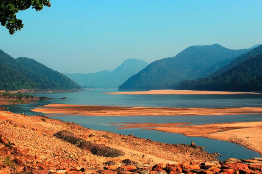
5.Krishna
The river Krishna is referred to as Krsnavena in the Puranas and Kanhaperna in the Jatakas. The Krishna River is the peninsular India’s second largest river, after the Godavari River. River Krishna rises in the Western Ghats near Mahabaleshwar in Maharashtra, about 64 kilometres from the Arabian Sea. It runs the length of the peninsula, from the western ghats to the Bay of Bengal.
The Krishna River begins in Maharashtra and flows through Karnataka, Telangana, and Andhra Pradesh before joining the Bay of Bengal. The Krishna river basin is heavily used for agriculture; nearly 75% of its basin is agricultural land.
before joining the Bay of Bengal The Krishna River has formed a large delta that has now extended up to 35 kilometres into the Bay of Bengal. The Krishna delta appears to be merging with the Godavari delta.
Major Tributaries -Bhima (north) and Tungabhadra (south)
Major Dams – Almatti Dam, Srisailam Dam, Nagarjuna Sagar Dam, and Prakasham Barrage
the 5th in the largest rivers in India the krishna has a list of tourist visit points:
| Satara | Maharashtra | Origin of Krishna River |
| Karad | Maharashtra | Famous for Hill Forts and Temples |
| Sangli | Maharashtra | Known for Fruits and Vegetables Production |
| Bagalkot | Karnataka | Heritage Site, Famous for Ancient Temples |
| Srisailant | Telangana | One of the 12 Jyotirlingas, Famous for Lord Shiva |
| Amaravati | Andhra Pradesh | Capital of Andhra Pradesh, Famous for Buddhist Sites |
| Vijayawada | Andhra Pradesh | Major Commercial and Business Center of the Region |
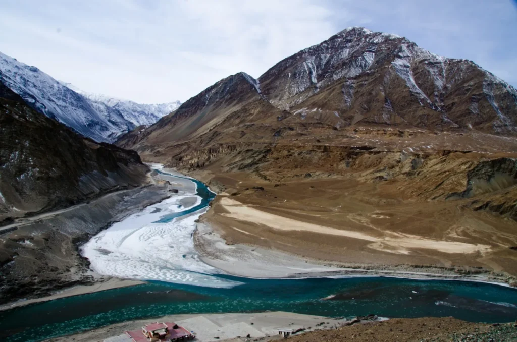
6. Indus
It begins near Mount Kailash and flows for 2900 Kilometres eastward before emptying into the Arabian Sea. The river flows through some of the most rugged terrain in India and Pakistan. The river has a large influence on the regional climate, agriculture, and water resources.
The Indus River originates on Mt. Kailash’s northern slopes in the Bokhar Chu (glacier) (6714m). It drains the major glaciers and mountain slopes, primarily in the Karakoram, Ladakh, Zanskar, and Himalayan Ranges.the 6th in the list of largest rivers in India
It originates on Kailash Mountain and flows through Tibet in a narrow valley known as Singi Khamban, or Lion’s Mouth.
It runs nearly straight through Ladakh between the Ladakh and Zaskar ranges. It flows for the first 480 kilometers along the northern flank of the Zaskar range, through the flat country at elevations of more than 3200 meters, before joining the Zaskar River below Leh.
The tributaries of the Shyok-Nubra join the Indus as it flows northwest. These tributaries are fed by the Siachin Glacier(Karakoram Range).
A short distance below the Shyok, the Shigar River joins the Indus River at Skardu. Gilgit is another significant tributary that flows west into the Indus.
Downstream, the Indus River carves a massive synclinal gorge through the central Himalayan range. The river flows through Nanga-Parvat before entering Pakistan from the southwest.
- Major tributaries of Indus river system
- Jhelum
- Chenab river
- Ravi river
- Beas river
- Satluj river
7.Brahmaputra
The Brahmaputra river (Sanskrit: ब्रह्मापुत्र Brahmaputra), also called Tsangpo-Brahmaputra, is a transboundary river in Asia.At 2,900 kilometres, it is Asia’s sixth-longest river (1,800 mi). It rises on the Tibetan Plateau and flows east for over 2,900 kilometres before emptying into the Bay of Bengal. The Brahmaputra is a vital transportation and irrigation artery for the countries it flows through, which include India, Bangladesh, and Tibet. The river is home to a diverse range of wildlife, including several endangered species.
The 7th in the list of the largest rivers in India.
Its origins can be traced back to the Chemayungdung mountain ranges near Mansarovar Lake in southern Tibet.
The Tamchok khambab spring is thought to be the source of the Brahmaputra River.
In Tibet, it is known as the Tsangpo or the Yarlung Tsangpo, and it flows parallel to the Himalayan ranges before entering India through Arunachal Pradesh.
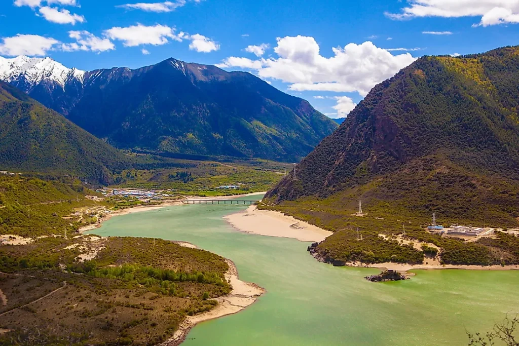
The Tsangpo River (Brahmaputra) enters India at Bishing and is known as the “Siang River” from there.
The Brahmaputra enters India as the Siang or Dihang river in Arunachal Pradesh. After joining its tributaries, the Lohit and the Dibang rivers, the river became known as the Brahmaputra.
Major tributaries –
- Subansiri river
- Lohit river
- Manas river
- Kopili river
- Jaldhaka river
- Dibang river
- Kameng river
- 5 Dhansiri river
- Raidak river
- Burhi Dihing river
- Sankosh river
- Teesta river
8.Mahanadi
The Mahanadi river originates at a height of 422 meters above mean sea level near to Pharsiya village, Nagri town in Raipur district of Chhattisgarh.
Mahanadi river of peninsular India is one of the major inter-state east flowing rivers.
The length of Mahanadi river from its source of origin to its confluence in the Bay of Bengal is nearly 851 Km, of which, 357 Km lies in Chhattisgarh and remaining 494 Km in Odisha.
the 8th in the list of the largest rivers in India. In Water Potential the Mahanadi river ranks second to the Godavari river among the peninsular rivers.
The basin of Mahanadi river is bounded on various sides
On the north by the Central India hills
On the south & east by the Eastern Ghats
On the west by the Maikala range.
Mahanadi river tributaries
Left Bank tributaries:
- Seonath
- Hasdeo
- Mand
- Ib.
Right Bank tributaries:
- Ong
- Tel
- Jonk.
9. Kaveri
Kaveri river, also known as the Ponni river, is famous as the Ganga of the South. Source ( Godavari is Dakshin Ganga )
Kaveri river Originates at Talakaveri at an elevation of 1341 meter above sea level in the western ghats, Brahmagiri range in Coorg district of Karnataka.
9th in the list of the largest rivers in India. The total length of the Kaveri river from the origin to its outfall into the Bay of Bengal is 800 Km.
The Cauvery basin is bounded by
Tungabhadra river basin lies on the Northside, and Palar river basin lies on the Southside of Kaveri river basin.
The Western Ghats form the western boundary.
The Nilgiri mountain range extends Eastwards towards the Eastern ghats and divides the Kaveri river basin into two – natural and political regions:
Karnataka plateau in the North and The Tamil Nadu plateau in the South.
the Kaveri river basin physically is represented by three parts –
the Westen Ghats,
the Plateau of Mysore
The Delta.
The delta areas of the basin are the most fertile parts. Alluvial soils are found in the delta areas.
The major soil types found in the Kaveri basin are black soils, red soils, laterites, alluvial soils, mixed soils and forest soils.
Red soils occupy the largest areas of the basin.
10.Tapti
With a length of 724 kilometres, the Tapti River is one of peninsular India’s major rivers. The Tapti River’s headwaters are in Multai, Madhya Pradesh’s Betul district. The Narmada, Mahi, and Tapti rivers are the three major rivers that flow from east to west in peninsular India. The Tapti River has the second largest inter-state river basin that drains westward. Its primary drainage area is in Maharashtra, but it also drains areas in Madhya Pradesh and Gujarat. It has a drainage area of 65145 square kilometres, nearly 80 percent of which is in Maharashtra. Tapti River Drainage Area Distribution- State by State Tapti travels 282 kilometres in Madhya.

.The common boundary between Maharashtra and Madhya Pradesh is 54 kilometres long.
The Tapti river flows through Maharashtra for 228 kilometres before entering Gujarat. The Tapti River flows through Gujarat for 214 kilometres before joining the Arabian Sea via the Gulf of Cambay/Khambat after passing through Surat.
The Tapti river also receives tidal influence for nearly 25 kilometres upstream from the mouth.
10th in the list of the Largest rivers in India The Tapti has several tributaries on both banks. There are majorly 14 tributaries of the Tapti having a length of more than 50 km.
Tapti’s left bank drainage system is more extensive as compared to the right bank area.
Four right bank tribuataries:
- Vaki
- Gomai
- Arunavati
- Aner
Left bank tributaries are
- Nesu
- Buray
- Panjhra
- Bori
- Girna
- Waghur
- Purna
- Mona
- Sipna